× Geoscan Sputnik GIS 1.4.11208 Close
Geoscan Sputnik GIS 1.4.11208 | 427.0 mb
The Geoscan Group product team is pleased to announce the availability of Sputnik GIS 1.4. A new version of Sputnik GIS presents new tools, optimized performance, usability, and new integration capabilities.
What's new in Sputnik GIS 1.4
Optimization and integration capabilities:
Sputnik GIS 1.4 has a new paradigm of working with geodata inside a project, in new version user may set up coordinate reference system for the whole project using EPSG base or import proper *.prj file. All geodata inside project will be transformed into a project coordinate reference system on the fly. Sputnik now supports LIDAR point clouds, with this feature LIDAR point clouds may be used in combination with orthomosaic and 3D models reconstructed from an aerial survey. A new user interface makes easier to work with basic tools and geometries during vectorization process.
Surveying and mapping:
For surveying purposes, we have implemented new tool for working with surfaces – «Relief editor». With this tool user may delete features from the surface, to create DTM from DEM for example, or model new features with 3D geometries, in addition, «Kriging-interpolation» tool is optimized. For operative and field mapping purposes «Image projection» tool is implemented, with this tool user may create mosaic with raw spatial reference from aerial survey photos.
Urban planning:
For the analysis of the urban environment, the tools daylight modeling, visibility area, and observation point are implemented. With the help of daylight modeling tool specialist may estimate the insolation conditions of territory in a given date and time. Visibility area tool along with observation point tool allows to model viewpoints and blind spots. Sputnik GIS helps to present city development projects in an intuitive environment (three-dimensional model of the city), which facilitate the process of discussion and decision-making. For creating the presentation, materials of the design solutions implemented a set of special tools: Video tour and animated track. With presentation tools, a three-dimensional model of the city easily turns into an animated scene with the ability to record video.
× Geoscan Sputnik GIS 1.4.11208 Close
Sputnik GIS is a professional drone surveying software for engineers, surveyors, and urban planners. Visualize and analyze multidimensional spatial data with no limits on data size, create surveys and get insights from your drone data in height performance GIS solution.
Spuntik GIS video tutorial - Calculating contours and triangulation
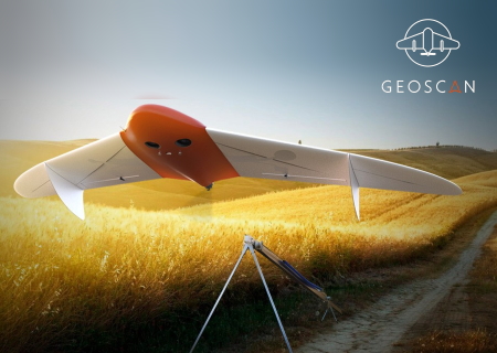
Geoscan Group is Russian manufacturer of unmanned aerial vehicles (UAV) and developer of photogrammetric data processing and three-dimensional data visualization software.
Product: Geoscan Sputnik GIS
Version: 1.4.11208
Supported Architectures: x64
Website Home Page : www.geoscan.aero
Language: english
System Requirements: PC *
Supported Operating Systems: *
Size: 427.0 mb
* System Requirements: Windows XP,7,8 (32/64bit)
1 Gb HDD free space (used for application files and cached data)
2 Gb RAM
Video: Nvidia, ATI/AMD, Intel HD 4000, 1Gb VRAM
Please visit my blog
Added by 3% of the overall size of the archive of information for the restoration
No mirrors please
× Geoscan Sputnik GIS 1.4.11208 Close
Download File Size:437.15 MB