× Topodrone Toposetter 2.0 PRO version 1.0.0.21 Close
Topodrone Toposetter 2.0 PRO version 1.0.0.21 | 211.7 mb
The Topodrone SA development team is pleased to announce the availability of Toposetter 2.0 PRO version 1.0.0.21 is a simple, yet powerful tool for automated postprocessing GNSS data in any coordinate system and replacing coordinates in image EXIF tags with precise coordinates from postprocessed GNSS data.
TOPOSETTER 2.0 Pro has additional features, providing even more efficiency in workflow automatization, reducing manual labor and saving time for further data processing:
- Processing GNSS data in any coordinate system
- Loading coordinate systems via PRJ files
- GNSS data postprocessing
- Additional GNSS data settings
- Converting GNSS data from UBX file format to RINEX
- XYZ antenna offset settings
- Antenna tilt corrections based on drone IMU data
- Calculating calibrated camera focal length
- Correcting XY photo coordinates based on the exposure time
- Batch processing of data from a single base
- Automatic image and coordinate matching
- Automatic image renaming
- Writing precise XYZ coordinates of horizontal and vertical discrepancy into image EXIF-tags
- Saving Pix4Dmapper and Agisoft Metashape compatible text files
- Calculating base station coordinates with PPP technology
- Working with JPG, TIFF and DNG image formats for uploading aerial images
× Topodrone Toposetter 2.0 PRO version 1.0.0.21 Close
TOPOSETTER 2.0 PRO is designed for GNSS data postprocessing and images geotagging and greatly automate and simplify the GNSS data processing and initial preparation of aerial photography materials for subsequent photogrammetric processing.
TOPOSETTER 2.0 Pro - GNSS Data Processing
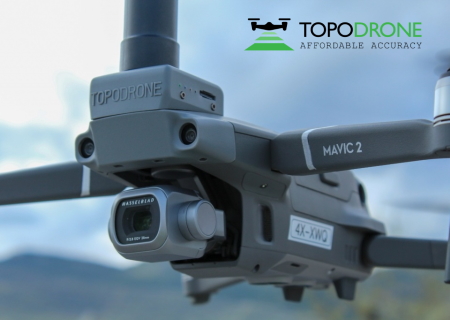
Topodrone SA designs, produces and offers to clients professional survey grade solution for UAV mapping and 3D modeling based on DJI Mavic 2 Pro, DJI Phantom 4 Advanced / Pro / Pro v2.0, DJI Matrice 200 V2 / 210 V2 and DJI Matrice 600 Pro
Ready-to-fly and easy to use DJI drones with additionally installed L1/L2 GNSS multi-band receiver connected with modified and calibrated camera turns your drone to professional survey tool
Product: Topodrone Toposetter 2.0
Version: PRO version 1.0.0.21
Supported Architectures:
Website Home Page : https://topodrone.org/
Language: english
System Requirements: PC *
Size: 211.7 mb
* System Requirements: Any computer on Windows, no requirements as such.
Please visit my blog
Added by 3% of the overall size of the archive of information for the restoration
No mirrors please
× Topodrone Toposetter 2.0 PRO version 1.0.0.21 Close
Download File Size:209.4 MB